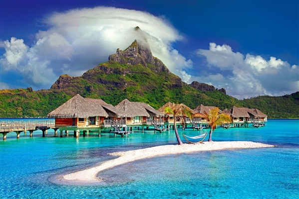
Probably, it will be a discovery for many that one of the regions of France is located almost in the center of the Indian Ocean and is a volcanic island. It can be called an earthly paradise among the endless ocean: everything here is picturesque, unusual and mysterious. Once here, you can once again marvel at the truly supernatural forces of Nature, which created this wonderful island of extinct and active volcanoes.
Where is

Reunion, located in East Africa, is the westernmost of the Mascarene Islands and covers an area of 2,152 sq. km. The discovery of the unique island belongs to the Portuguese navigator Pedro di Machareñas, who landed here on 02/09/1513, on the day of Saint Apollonia. The island was named after her in the beginning, and when the French took possession of it, it began to be called Reunion de Patriot.
Its entire territory is covered with extinct and active volcanoes, the cooled lava of which actually formed the Reunion.
One fifth of the territory is made up of solidified lava masses; the central territory is occupied by numerous circuses - ring mountains, enclosing circular plateaus, many of which are covered with fertile soil. It is home to a multi-ethnic population that grows sugarcane and other tropical crops.

The west of Réunion is adorned with pristine relict forests, among which cuttings are made for coffee, reed and banana plantations. The southeast is occupied by basalt plateaus with no volcanic soil. The southwest is represented by savannah with wildly growing grassy cover, alternating with sparse undergrowth. On the flat tops of the island mountains, tropical forests, picturesque meadow grasses and flowers grow.
Reunion Tourist Routes
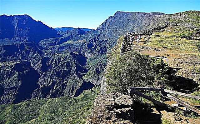
Watching volcanoes is the main type of tourism in Reunion. Thousands of those wishing to see with their own eyes the mighty natural element - the eruption of the deep bowels of the Earth - come to the island every year. They examine extinct volcanoes and the traces of their eruptions, amazed at the scale and strength of the once melted, fire-breathing masses.

Piton de Neige - the highest peak of an extinct volcano - is located in the northwestern part of the island and is considered the highest point in the Indian Ocean (3069 m). The huge volcano, which has lost its activity for more than 20,000 years, is badly destroyed. It is surrounded by three majestic mountain amphitheaters with the Silao, Mafat and Salazi circuses. There are 3 tourist routes of the 2nd class of difficulty to the top of Piton de Neige: through Salazi, Silao and Plaine de Kafr.
Volcano tour - what could be more interesting?
Guided tourists of all routes, after a long day's ascent, meet in a hotel stylized as a mountain hut. Here they organize an overnight stay, and before sunrise in the early morning they reach the summit to admire the rising star from it. Having examined the surroundings of the giant, the tourists go down the same routes. The ascent from Sialos takes 6.5 hours; from Plaine de Kafra - 8 hours; from Mafat - 9. Most choose a two-day hike, it requires less physical effort and allows even untrained people to overcome 3 km. heights. A one-day ascent is also organized, which takes 10-12 hours, which physically strong tourists, accustomed to mountain travel, risk.

The trails lead through the La Roche Ecrit National Park, its lush tropical greenery; through the mountain peak of the same name, from where, as in the palm of your hand, you can see the surroundings with circuses and craters; motley panorama of the capital Saint-Denis. During the ascent, you can see the craters Salazi, de Mafat, Silao; admire the Cascade de Bras Rouge waterfall, taste the water of local thermal springs.
Piton de la Fournaise volcano
Piton de la Fournaise is an active shield-type volcano with a height of 2631 m. Now it is a circus-shaped depression, the diameter of which is approximately 8 km. Translated from French, its name sounds like "The Top of the Furnace", which is very consistent with the frequent eruptions of incandescent lava pouring in a wide strip from the volcano's mouth. More than 150 liquid lava eruptions have been recorded since the 17th century, the most recent in May 2015. The image of an active volcano as the main symbol of the island is featured on the unofficial flag of Reunion.

Those who do not dare to climb to the Fournaise crater on foot can view the volcano from below, from different points of its foot. Extremists can see the active eruption of lava from a height, flying around the crater in a helicopter, when a red river of incandescent magma flows down in front of their eyes. During the period of activity, it is forbidden to approach the volcano at a distance of 10 km. Therefore, one can observe the fiery lava only from afar.
The rest of the time, hiking trails are organized to the crater, following which you can see the natural sights of these places, amazing in beauty and uniqueness. Here you can marvel at the view of relict forests, the highest waterfall in the world - Trou de Fer, unique in its width, the gorge of the same name (they go down into it only on a rope). The way up goes through the Beluv National Reserve, located at an altitude of 1.5 km. The cleanest air is dizzy, outlandish trees and bushes surround hiking trails and bridges. Cozy mini-hotels hospitably offer a place to spend the night with a delicious dinner and comfortable bedding.
A visit to the island of volcanoes is a journey into the world of exotic landscapes, majestic mountains, mysteries of the mysterious forces of the planet.
There are many interesting places in France, such as the Marquessac Gardens.